Update from October 10th 2025

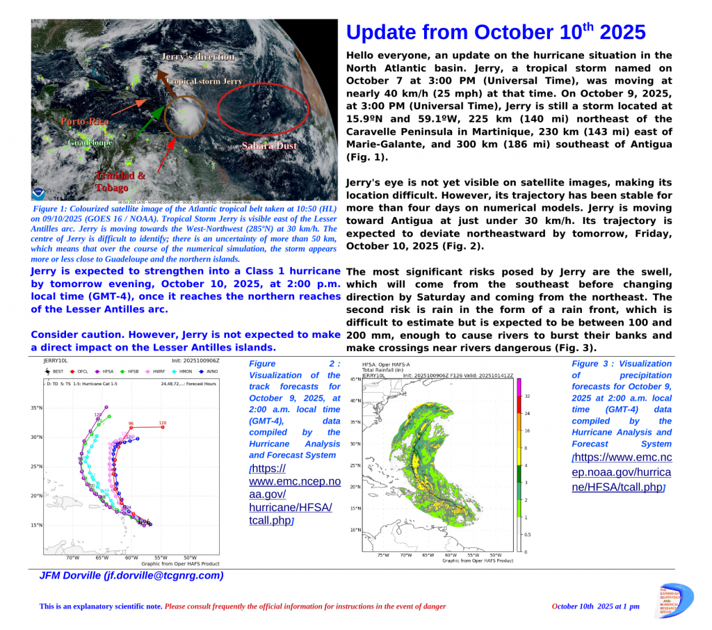
Tropical Storm Jerry is moving up the Lesser Antilles arc to within 220 km. It is closer than expected, but its centre is difficult to identify. The strongest winds are to the east and will not cross any landmass. It is expected to become a Class 1 hurricane once north of the arc on Friday, October 10th evening. The greatest risks are heavy rain and swell.
Caution is advised near rivers and the Atlantic coast.

Update from August 21st2025

Erin continues its path towards the north-east and northern Europe, leaving the Saharan sandbar that protects the Lesser Antilles diminished in places. Two disturbances are likely to cause heavy rain, to the north from Thursday 21 to Saturday 23 between Guadeloupe and the Virgin Islands and to the south over Trinidad and Tobago between Saturday 23 and Sunday 24.

Update from August 18th 2025

Erin continues its route and will follow the coasts of North America. It is a major hurricane, it evolves continuously and exposes the islands and coasts to swell (8m in places) and coastal flooding (up to 4m high).
The new atmospheric disturbance is worth monitoring.