For the last two days, a low-pressure zone and a layer of sand (dust) from the Sahara have been interacting in a harmonious dance.
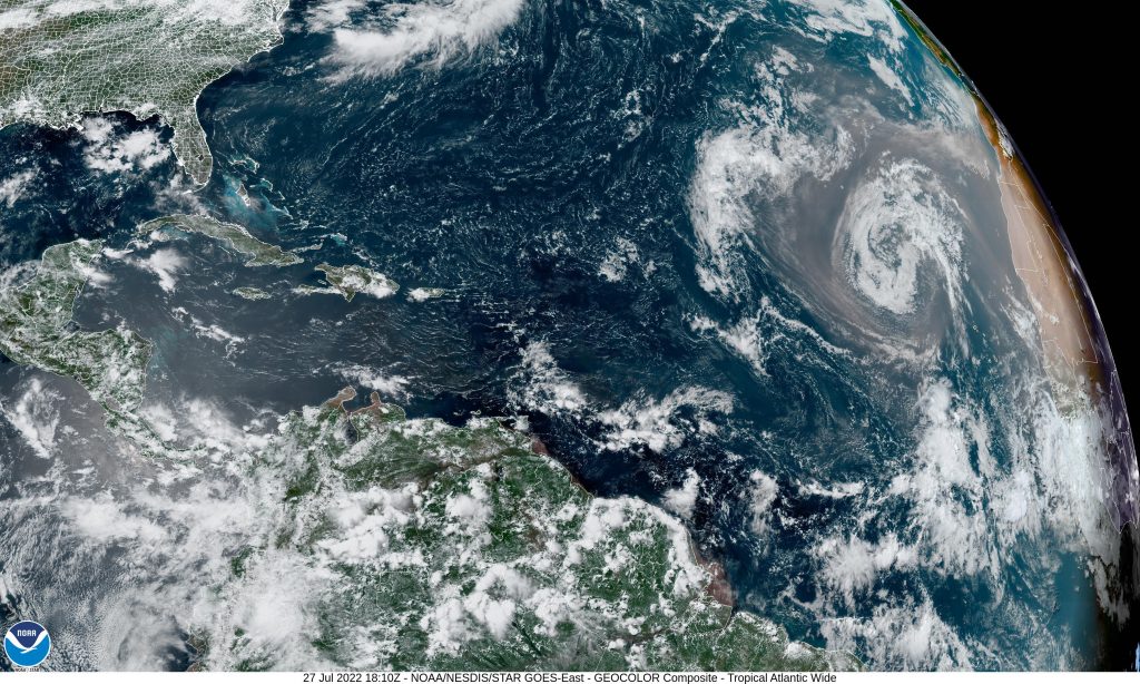
source : https://www.star.nesdis.noaa.gov/GOES/sector.php?sat=G16§or=taw
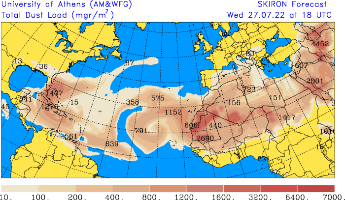
source : https://forecast.uoa.gr/en/forecast-maps/dust/north-atlantic
The Sahara dust limits the development of cloud structures in the low-pressure area and its convective movements, with progressive weathering visible on the animation. The depression favours the transport of the layer of dust towards North America.
The presence of Saharan dust in the atmosphere of the North Atlantic has many negative effects on health, in particular by reducing air quality with the presence of fine particles and bacteria. It also impacts the environment with a strong greenhouse effect which favours heat waves and drying of the air which modifies the frequency and the quantity of rainfall.
Conversely, the presence of particles modifies atmospheric dynamics, in particular cyclogenesis. In an atmosphere overloaded with sand, convection is limited or even stopped, cyclones have less favourable conditions to form.
The presence of large quantities of sand from the Sahara modifies our understanding of meteorology in the North Atlantic but also of the current and future climate. Years with large concentrations of Sahara dust disturb our perception of climate change.